Order Logic

Order Logic Advantages
Order Logic allows you to define your target either by using a map interface or importing a file. You can review the constraints and parameters to ensure they align with your objectives then submit the area of interest to receive feasibility results. Upon receiving a feasibility report, you can review the collection details and if necessary, adjust parameters and resubmit your request. The desired imagery can be requested once the feasibility is confirmed.
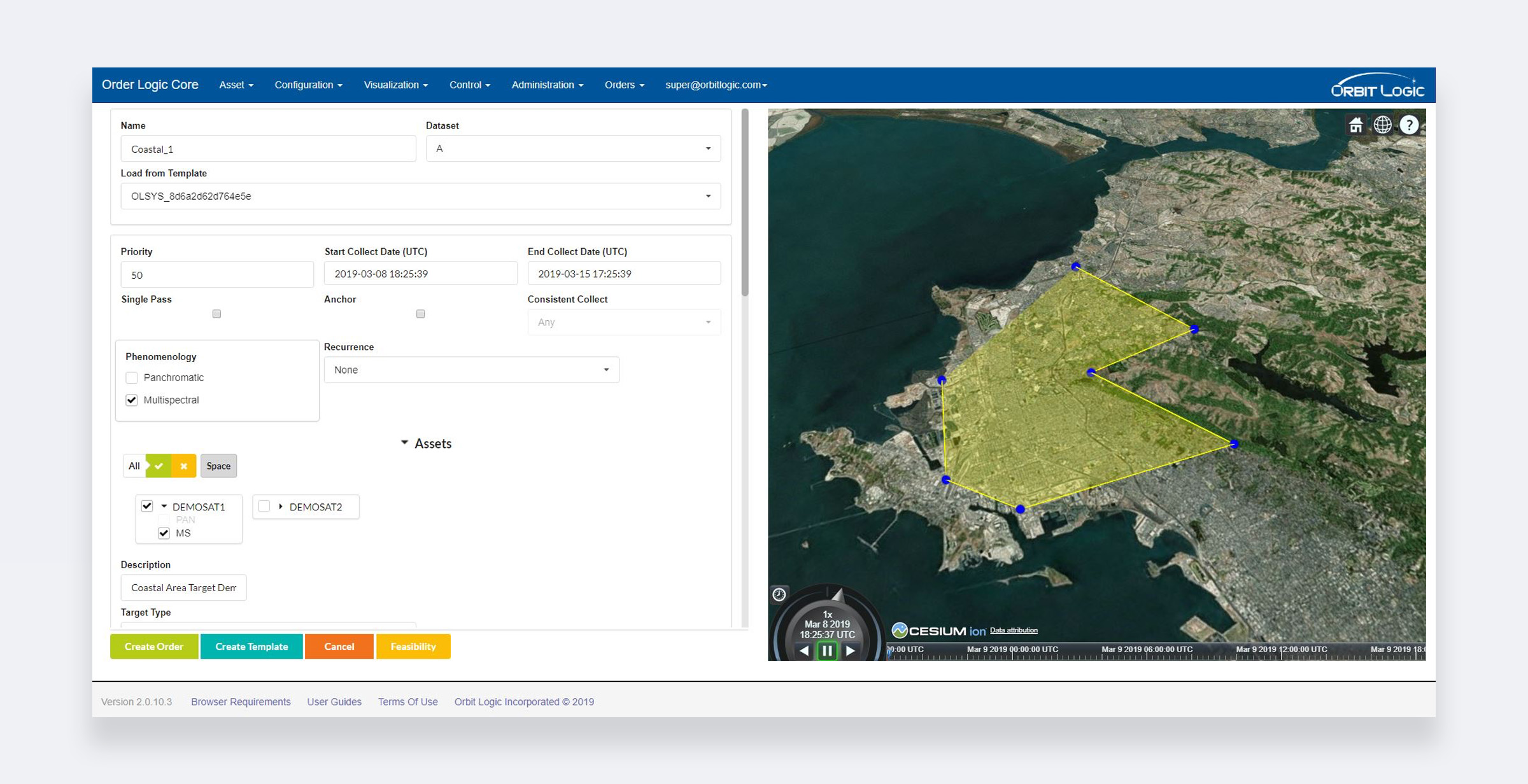
Order Logic Collection Request
Collection Feasibility Computations
Using statistical weather forecasts and long-term orbital dynamics Order Logic provides the likelihood of collection and downlink per the constraints and timeline.
Compute required strips and total scan time based on imaging mode
Compute constrained collection opportunities based on geographic location and orbital model
Order priority, statistical cloud cover, and competition from other orders near the area of interest are taken into account to determine both minimum and maximum expected time to collect
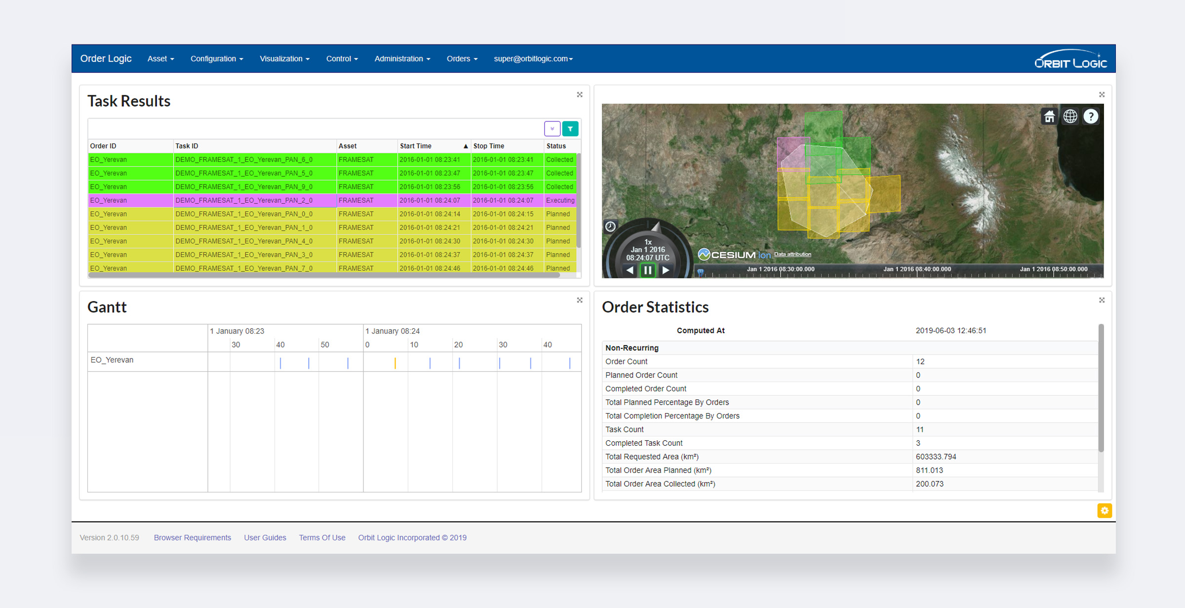
Order Logic Collection Order Details
Recorder and Downlink Impact
With limited onboard storage and downlink opportunities, recorder management becomes an important factor in timelines for the return of imagery .
Configure onboard storage space
Define downlink rate and compression ratios
Specify and configure available ground stations
Stipulate ground station options for each image
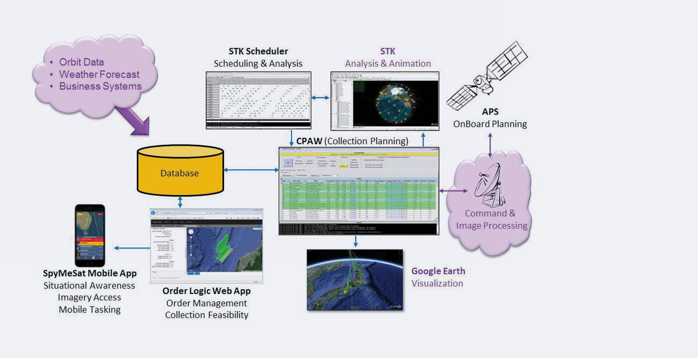
Orbit Logic System Architecture