Next Level Collection and Analysis
CPAW collection planning employs validated models to simulate and predict physical and spacecraft subsystem environments, ensuring operational-fidelity scheduling. It generates ready-to-use plans, not just access determinations, benefiting both satellite operators and imagery customers seeking maximum value from their budget.
Automated and Manual Planning
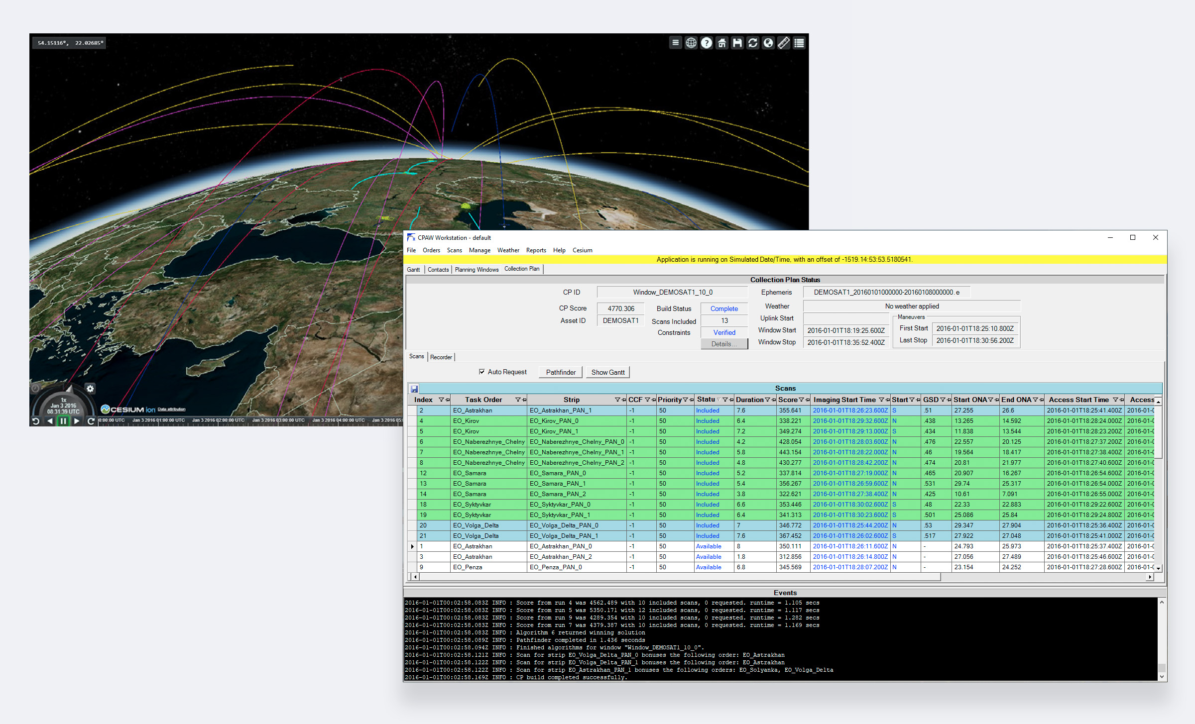
CPAW offers multiple algorithms for conflict-free collection plans. Users can edit plans manually with instant model validation. Lights-out mode generates “just-in-time” plans. Cesium visualization provides situational awareness for analysis, design, and system throughput.
Smart Constellation Planning
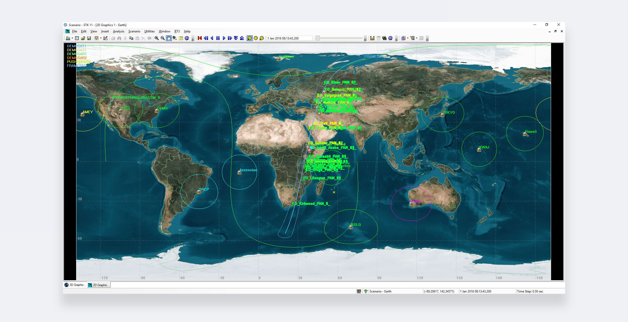
One CPAW workstation handles individual or collaborative constellation planning for diverse satellites. Task specifications are honored even with multiple satellites for cost-efficient completion of areas. Beyond static planning, CPAW also excels in dynamic tracking, offering real-time sensor collection plans for moving ground targets like ships, trains, and missiles. With adaptive monitoring capabilities, CPAW ensures you stay in control of even the most dynamic operational environments.
![]()
Contact Scheduling and Recorder Management
CPAW streamlines mission operations with automated contact scheduling and seamless integration of external schedules. It also provides advanced onboard recorder management, allowing users to customize settings for diverse mission requirements. Whether you’re managing a single satellite or a complex constellation, CPAW ensures optimal resource utilization and mission success.
Efficient Order Management
CPAW simplifies large-scale tasking with its robust order management system. It accepts external tasking requests, tracks fulfillment progress, and ensures efficient coverage of expansive areas. CPAW utilizes a user-friendly, web-based application, enabling seamless coordination and execution of complex missions.
Enterprise-Ready Solutions
Extend CPAW with Order Logic app and SpyMeSat for remote tasking. Custom deployments include distributed tasking and cloud computing for enterprise performance.
Swift Satellite Integration
CPAW quickly integrates new satellites with in-app parameter configuration. Plug-in interfaces support various imaging models for easy replacement and expansion.